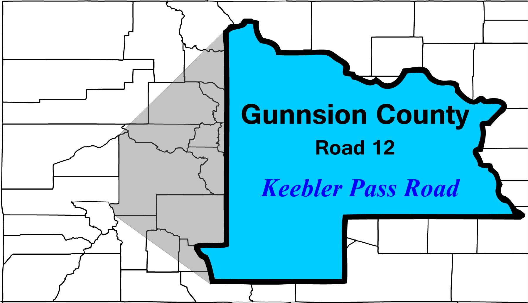
47 Slides
including Kebler Pass Road
Road Index click green ovals to jump ahead or behind user-contolled cycle: choose an automated cycle 2 seconds 5 seconds 10 seconds 30 seconds 60 seconds
❮
❯
1 / 47
2 / 47
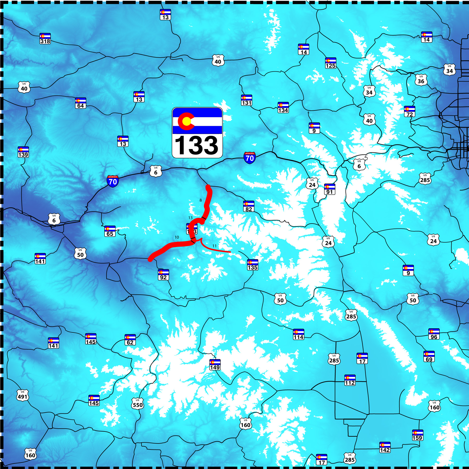
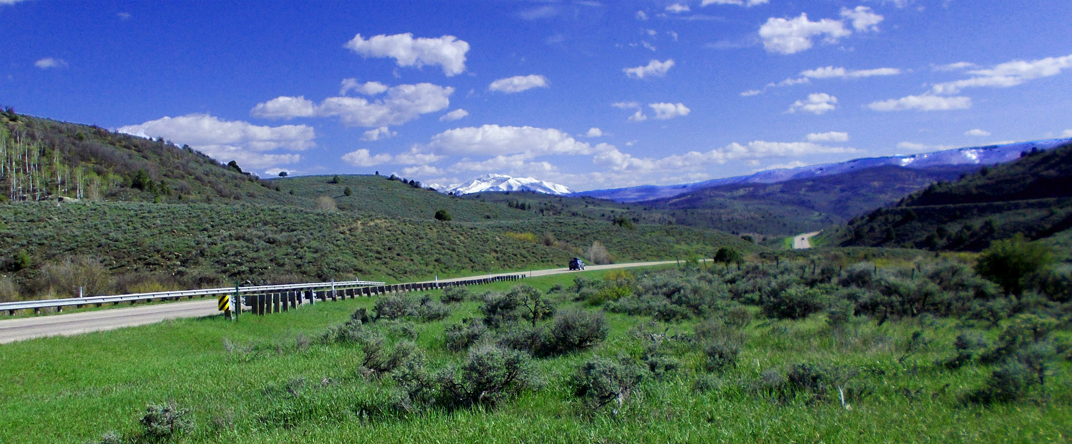
North End of CO 133
CO 82 in Carbondale
CO 82 in Carbondale
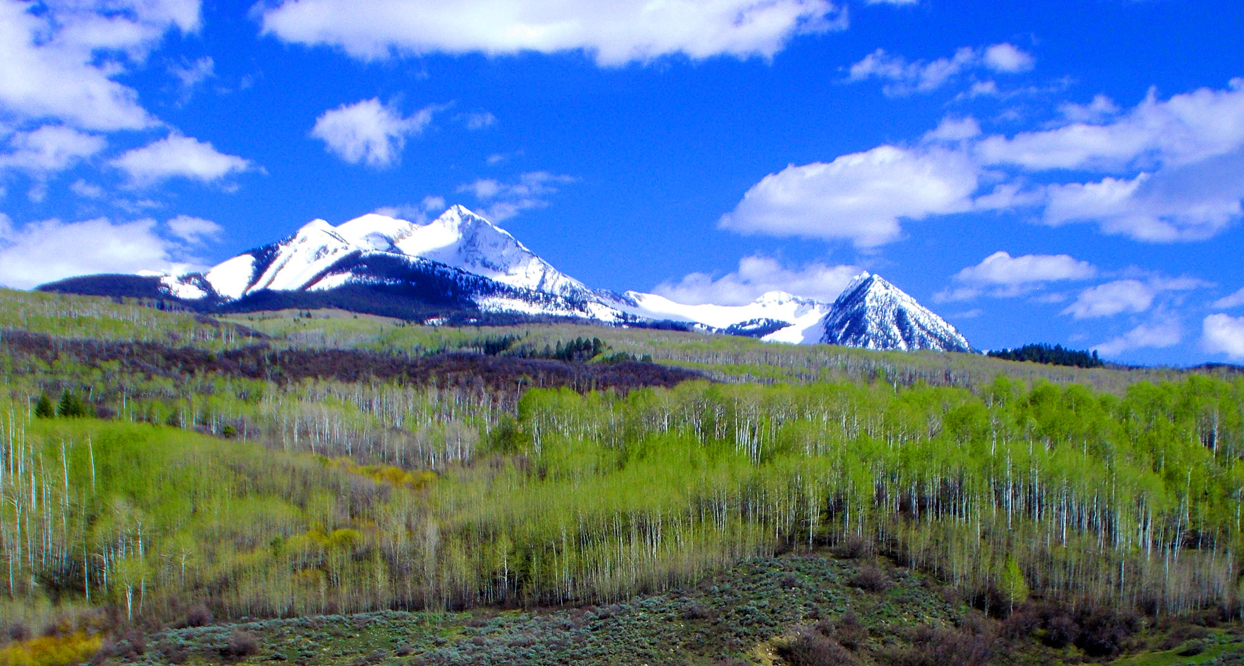
3 / 47
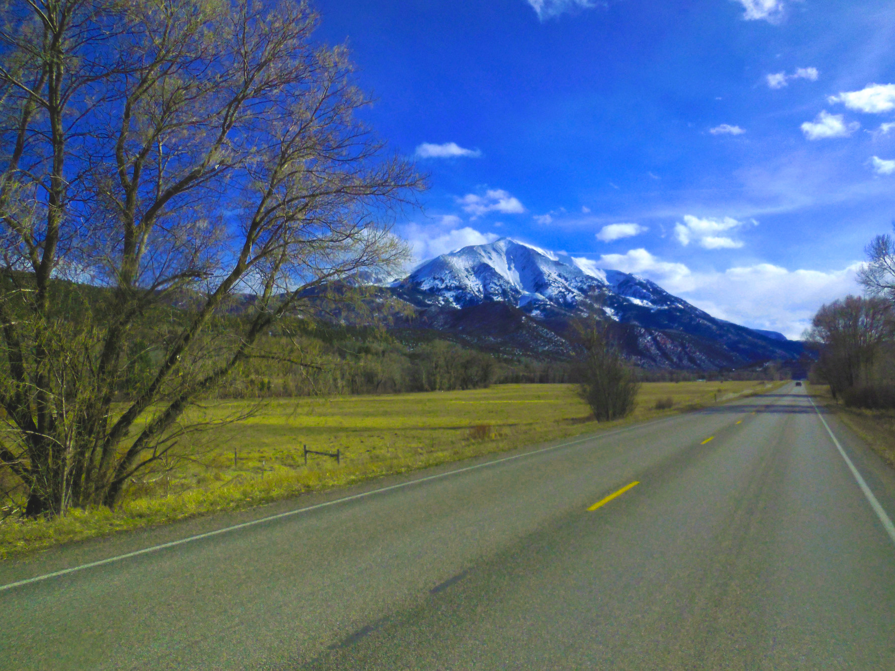
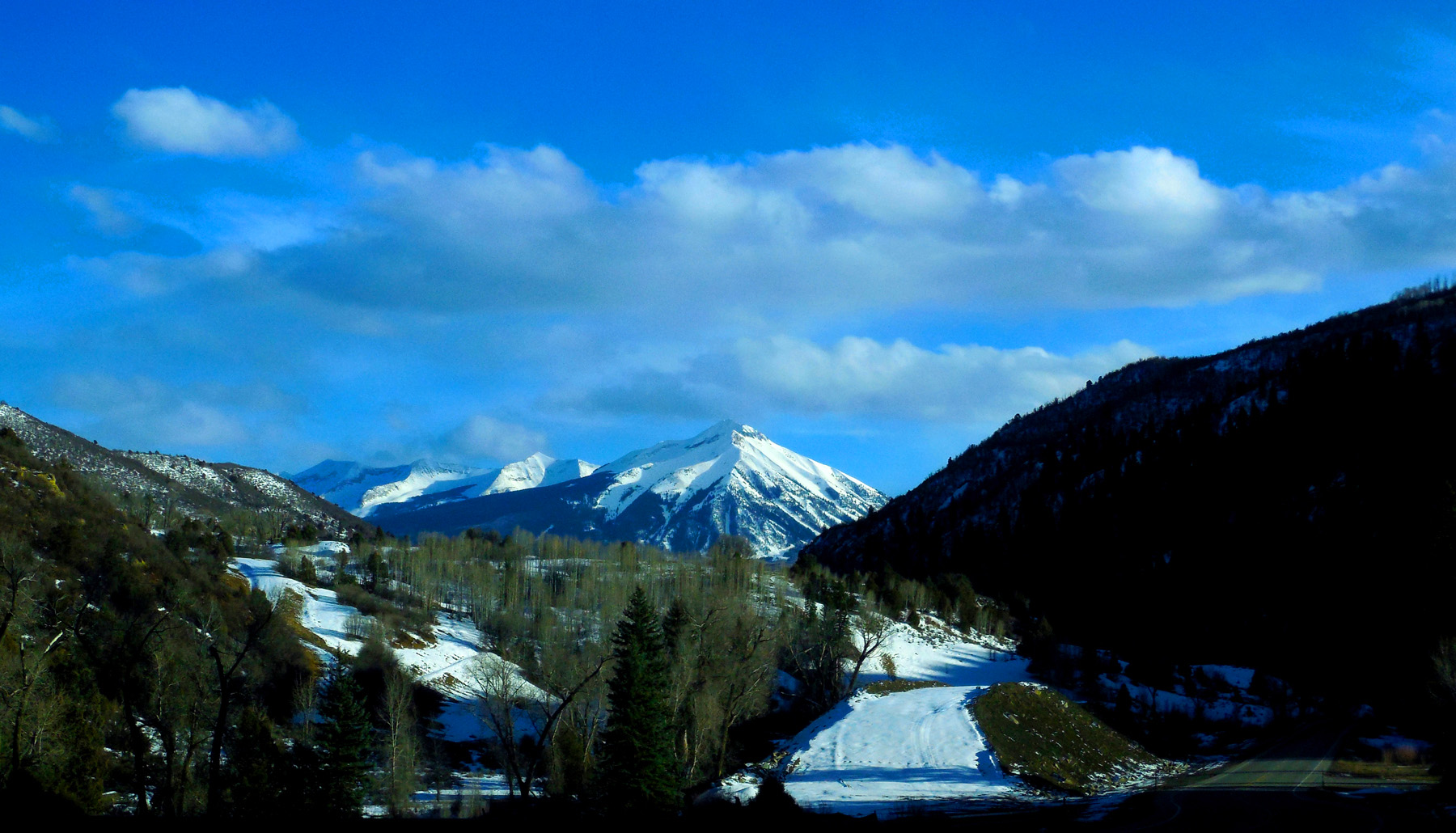
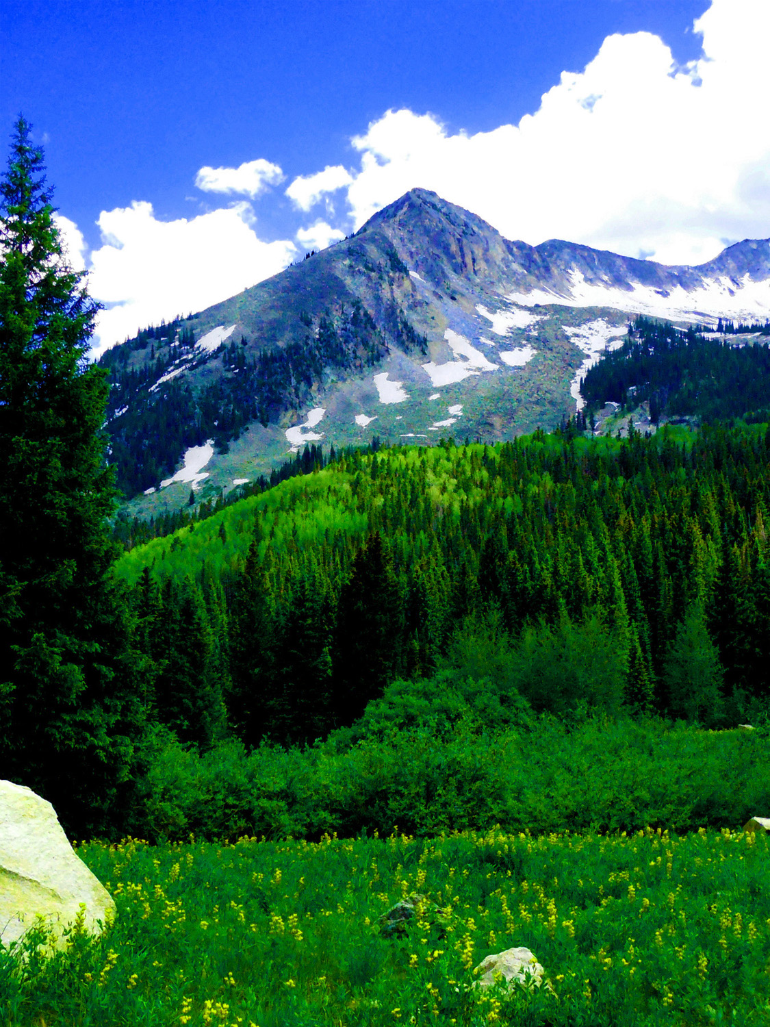
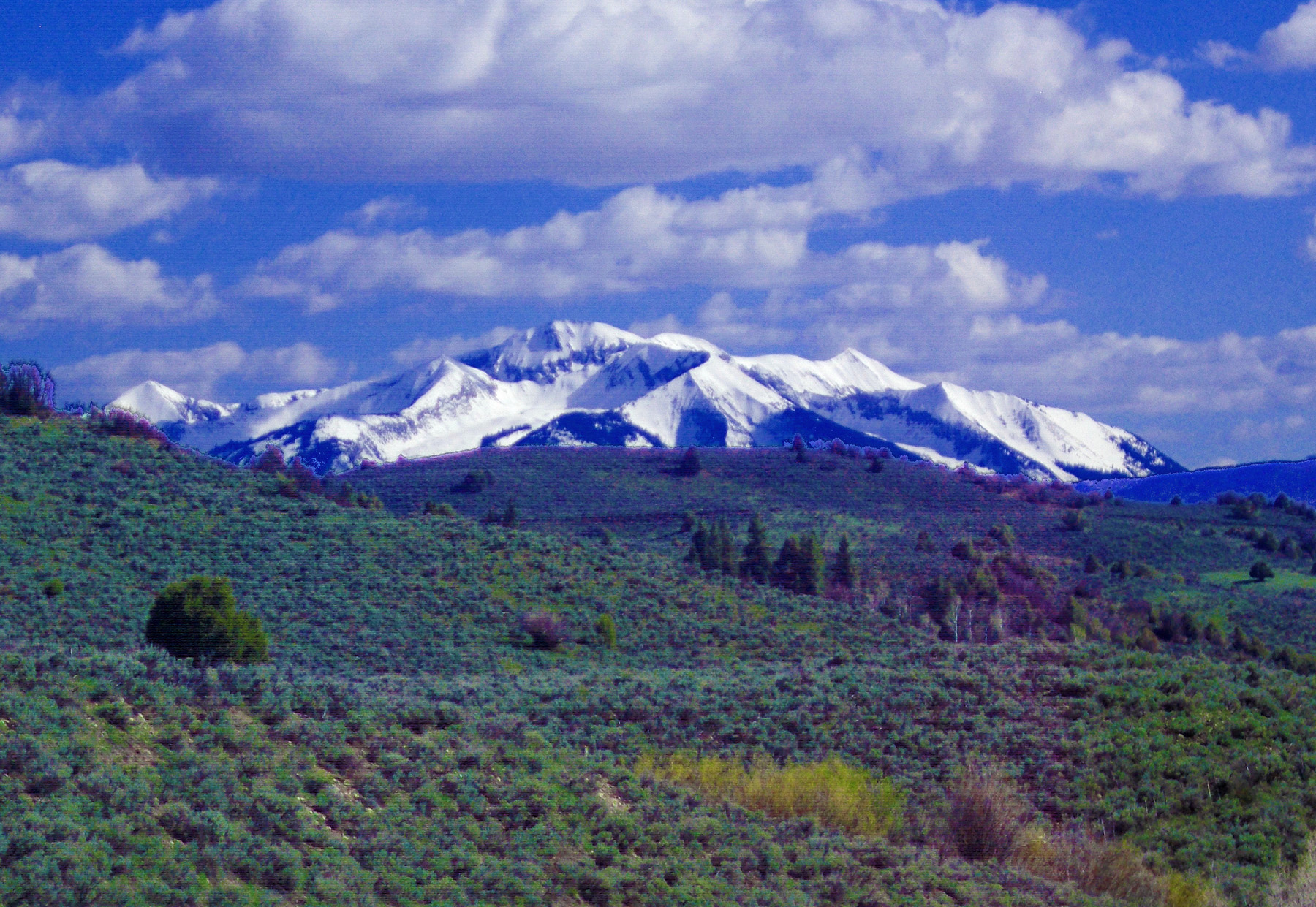
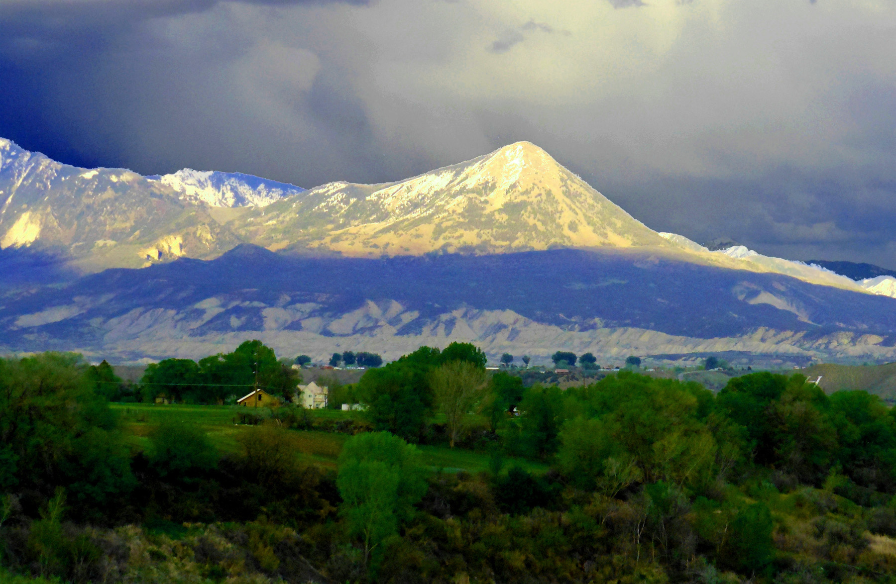
Mount Sopris (12,660') (northernmost of the West Elk Mountains)
Feb 26 2017 - 3:03 pm
Feb 26 2017 - 3:03 pm
4 / 47
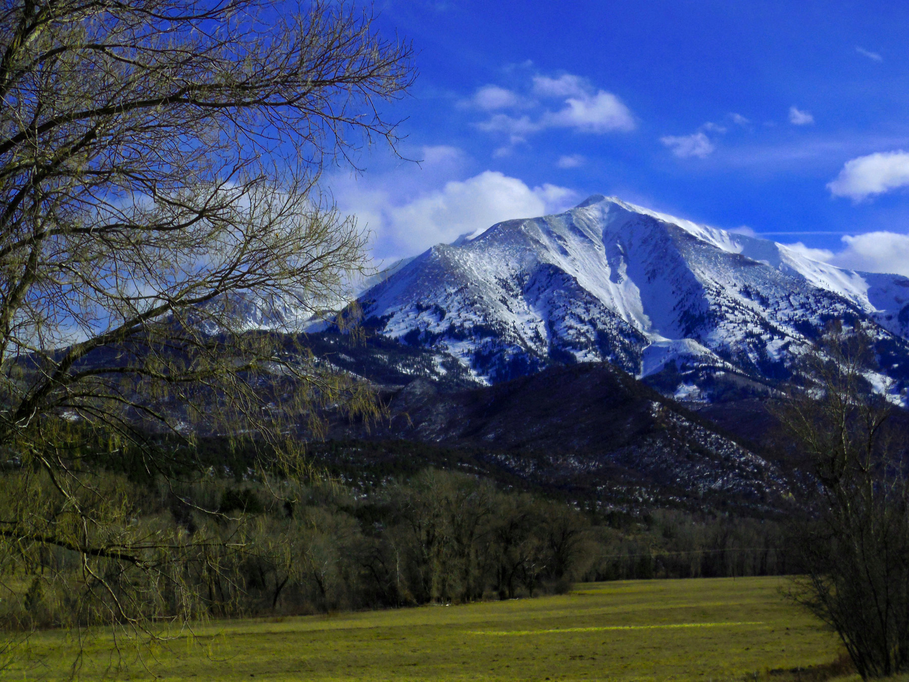
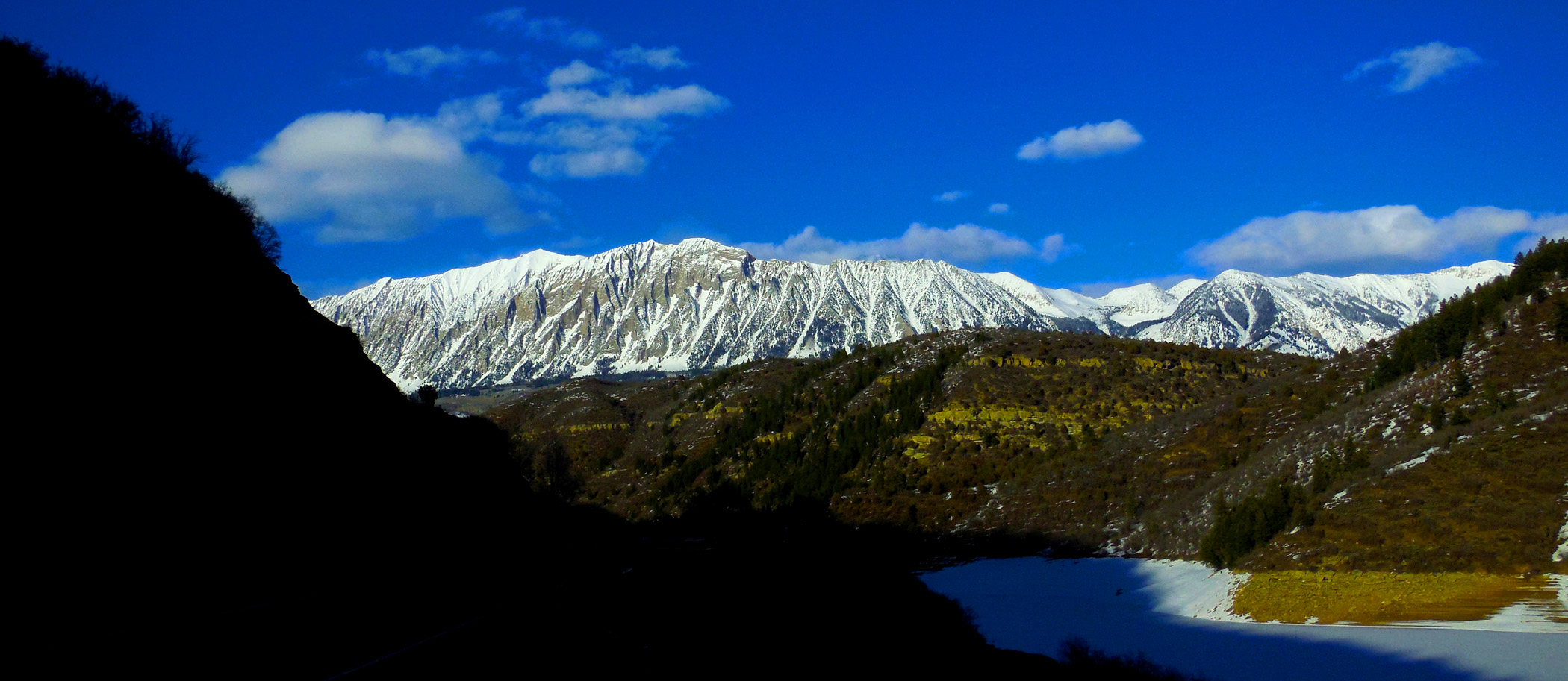
Mount Sopris and other West Elk Mountains are cored by granodiorite (many are laccoliths intruded about 30,000,000 years ago)
Feb 26 2017 - 3:03 pm
Feb 26 2017 - 3:03 pm
5 / 47
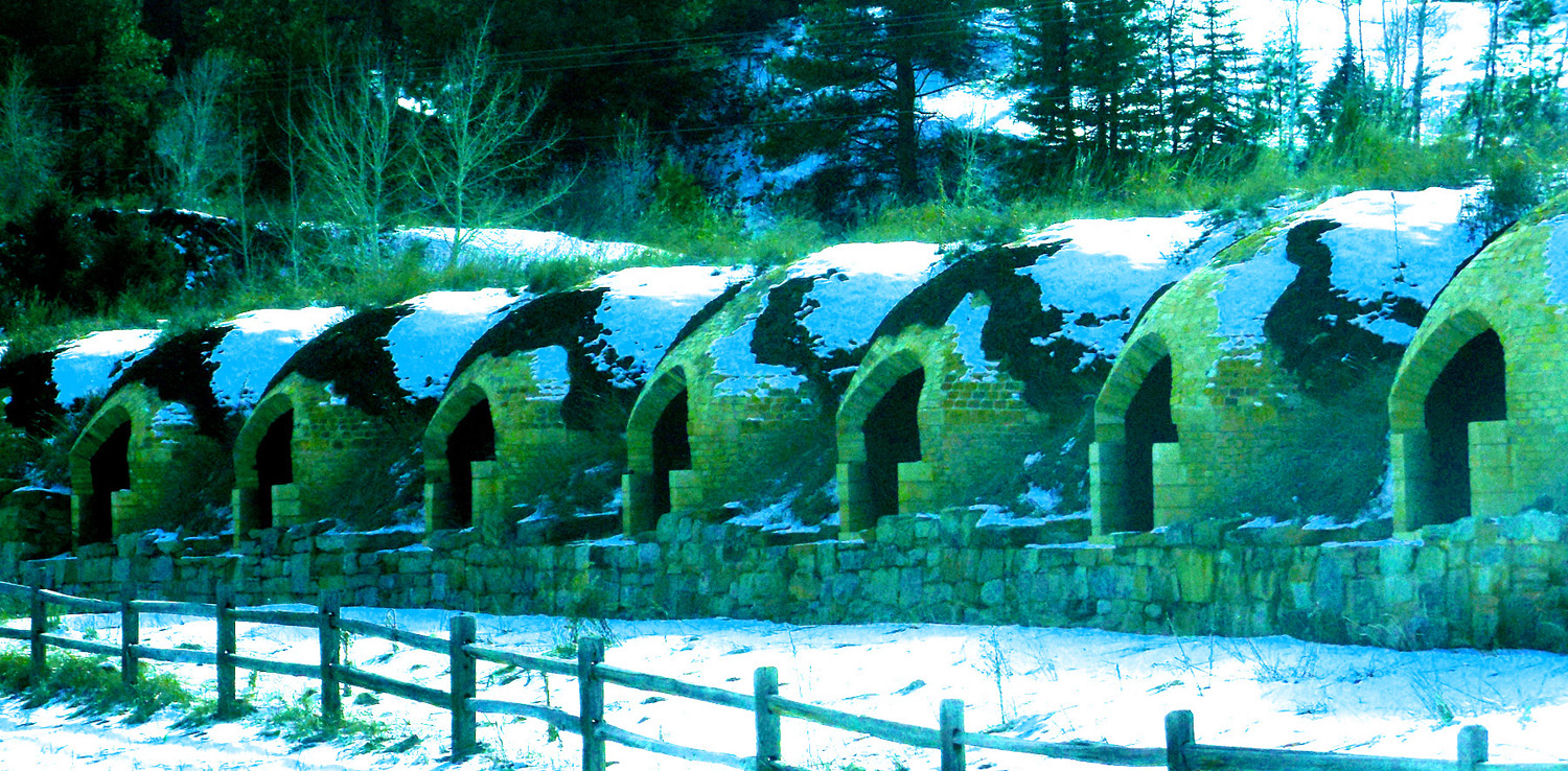
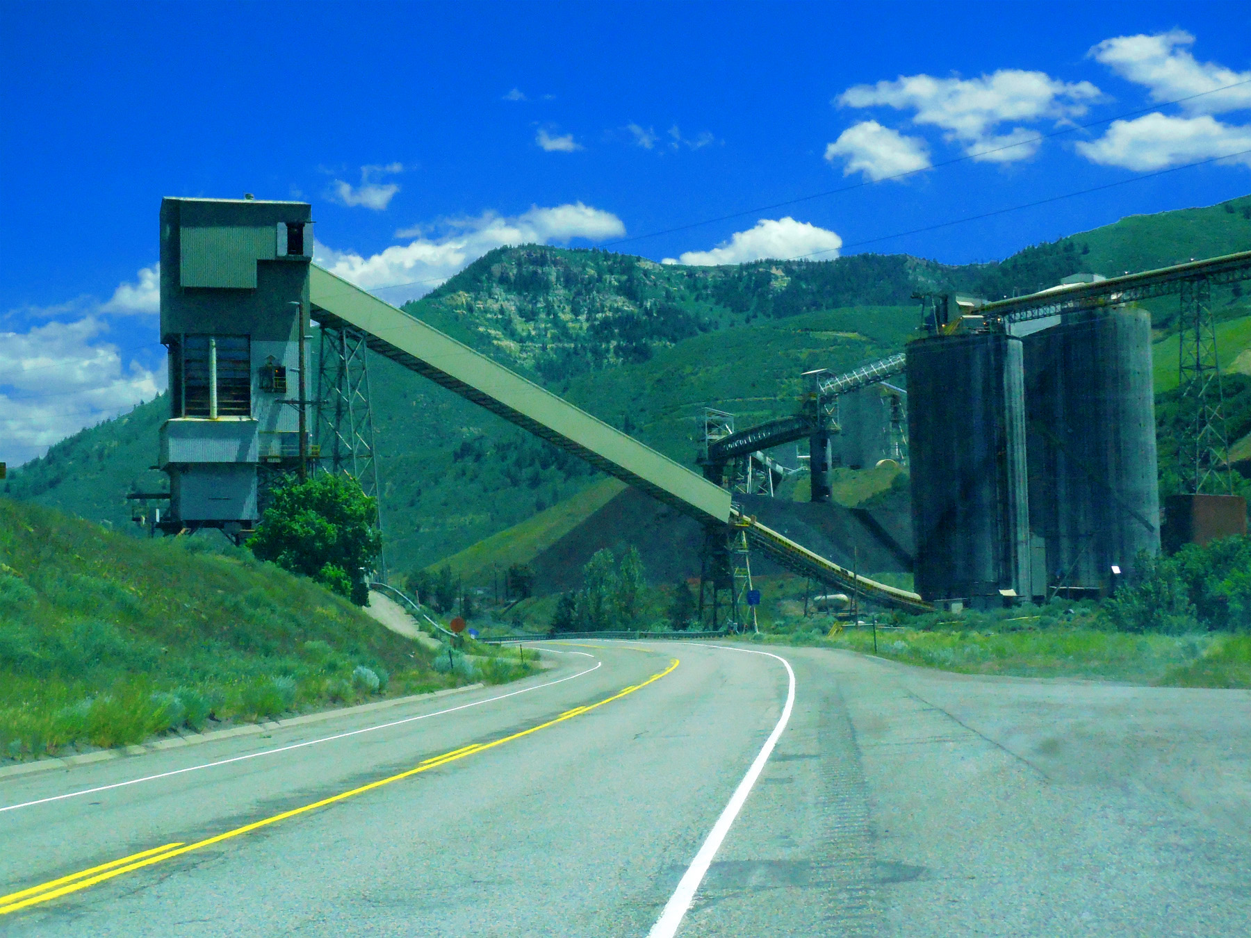
90 of 249 Coke Ovens preserved as an Pitkin County Historic District
Feb 26 2017 - 3:27 pm
Feb 26 2017 - 3:27 pm
6 / 47
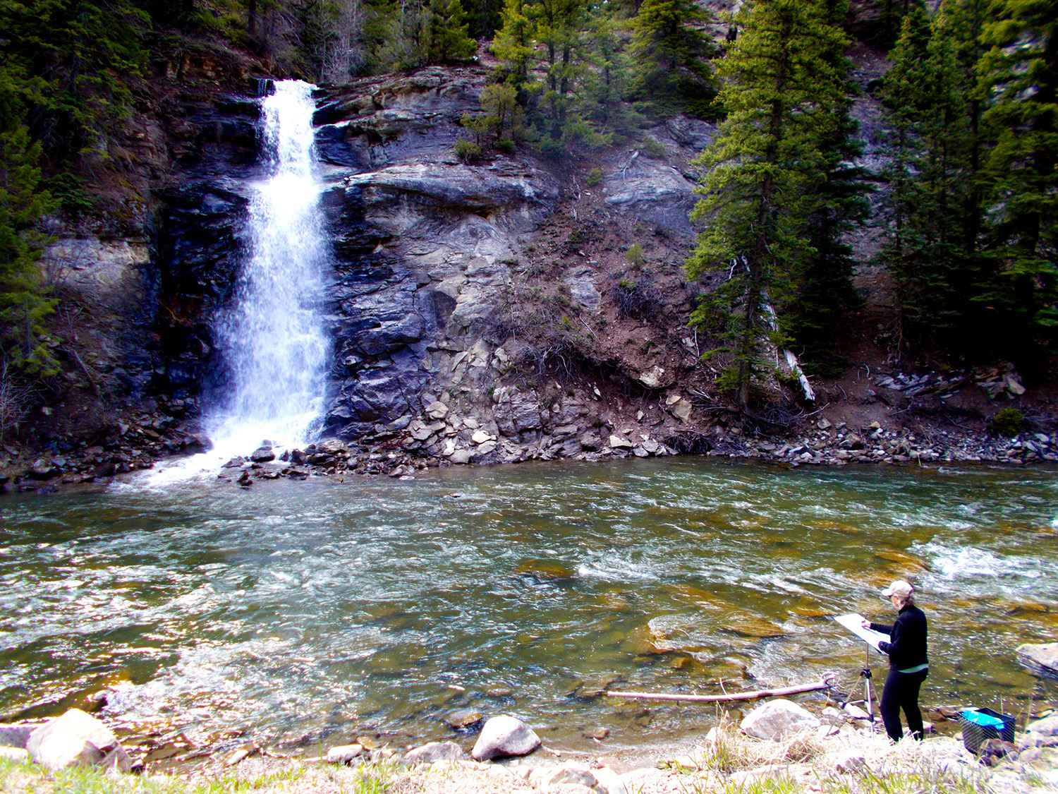
Falls to the Crystal River (spring snow melt, dry the rest of the year)
May 12 2019 - 4:00 pm
May 12 2019 - 4:00 pm
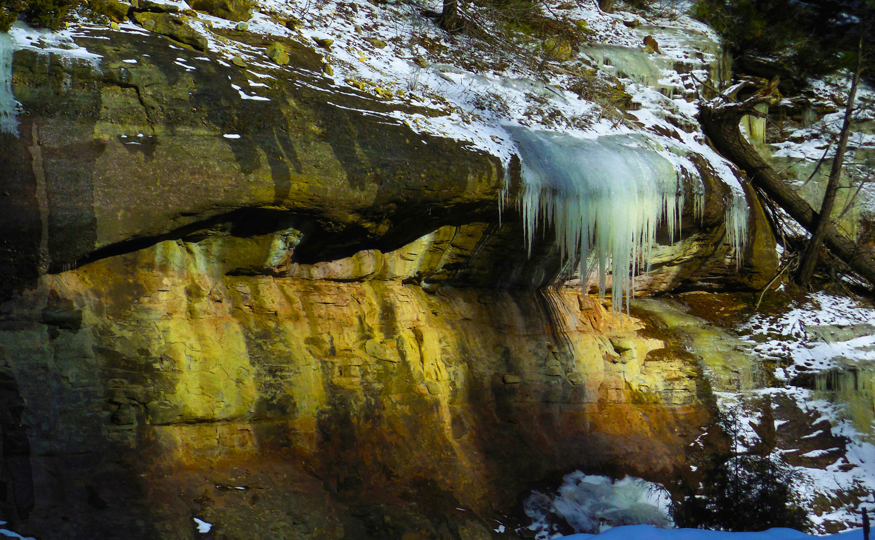
7 / 47
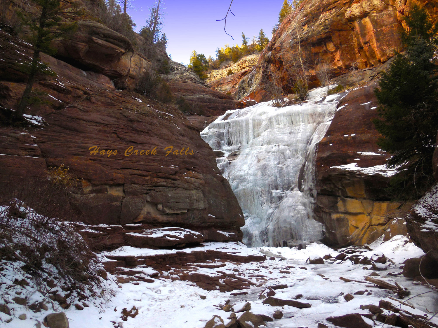
Frozen Hays Creek Falls (at the end of February)
Feb 26 2017 - 3:32 pm
Feb 26 2017 - 3:32 pm
8 / 47
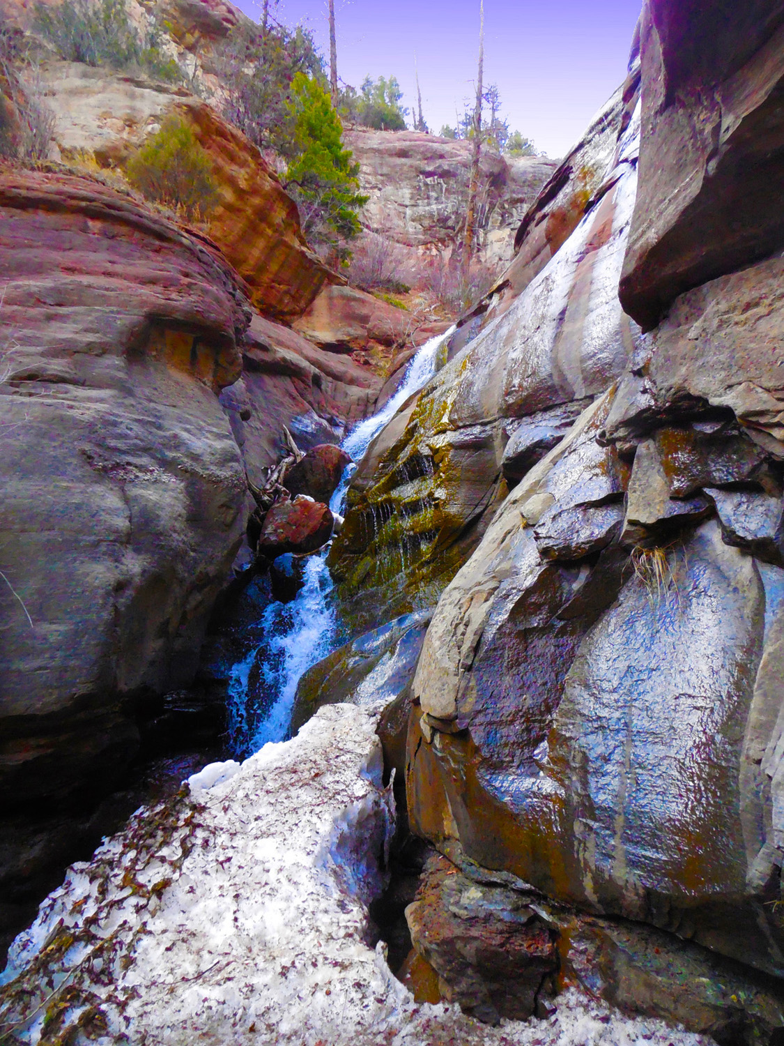
A Month and Year Later
Mar 30 2018 - 3:16 pm
Mar 30 2018 - 3:16 pm
9 / 47
Seepage on Top of Mesa Verde Sandstone
Feb 26 2017 - 3:35 pm
Feb 26 2017 - 3:35 pm
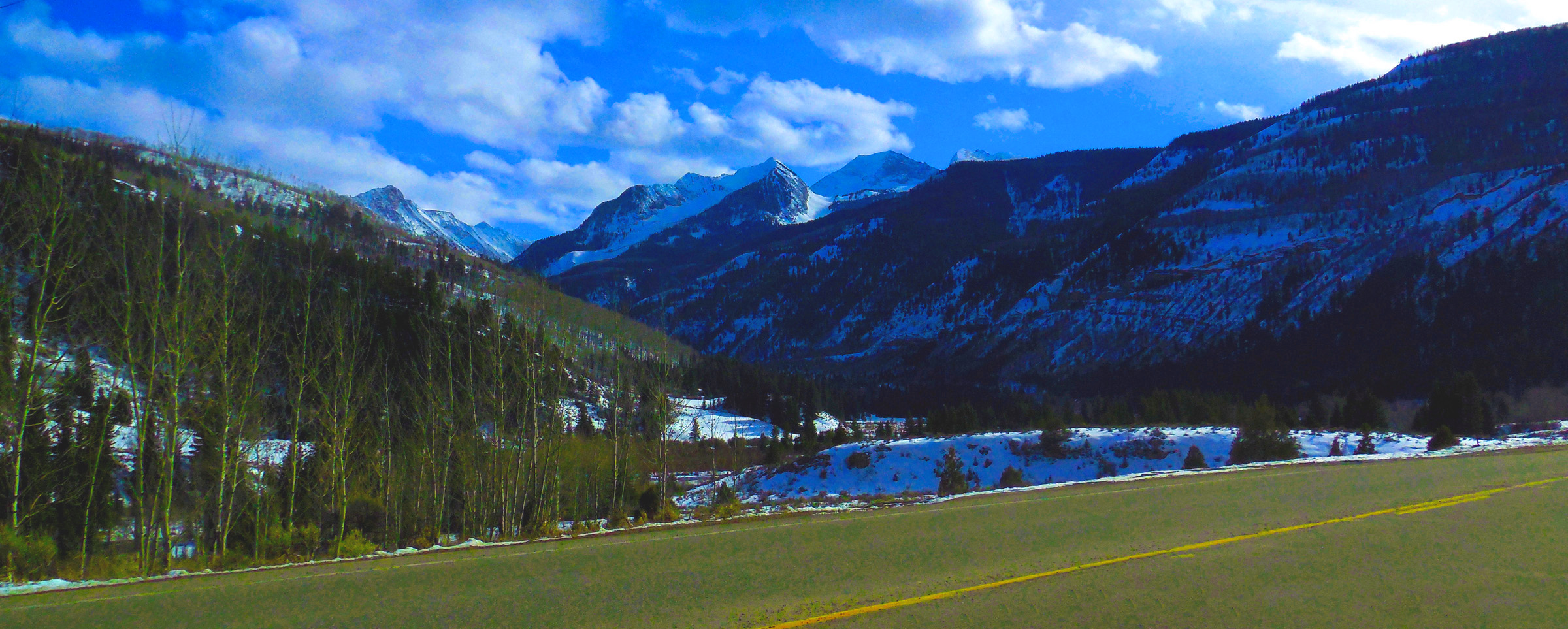
10 / 47
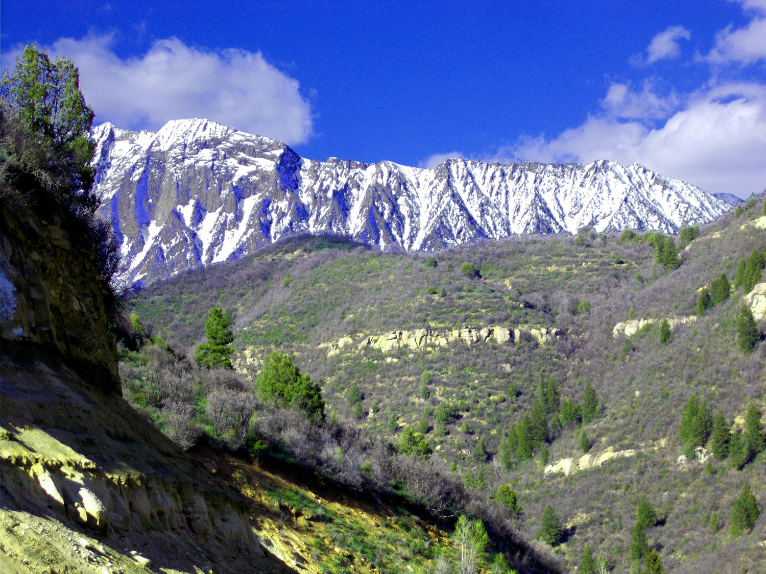
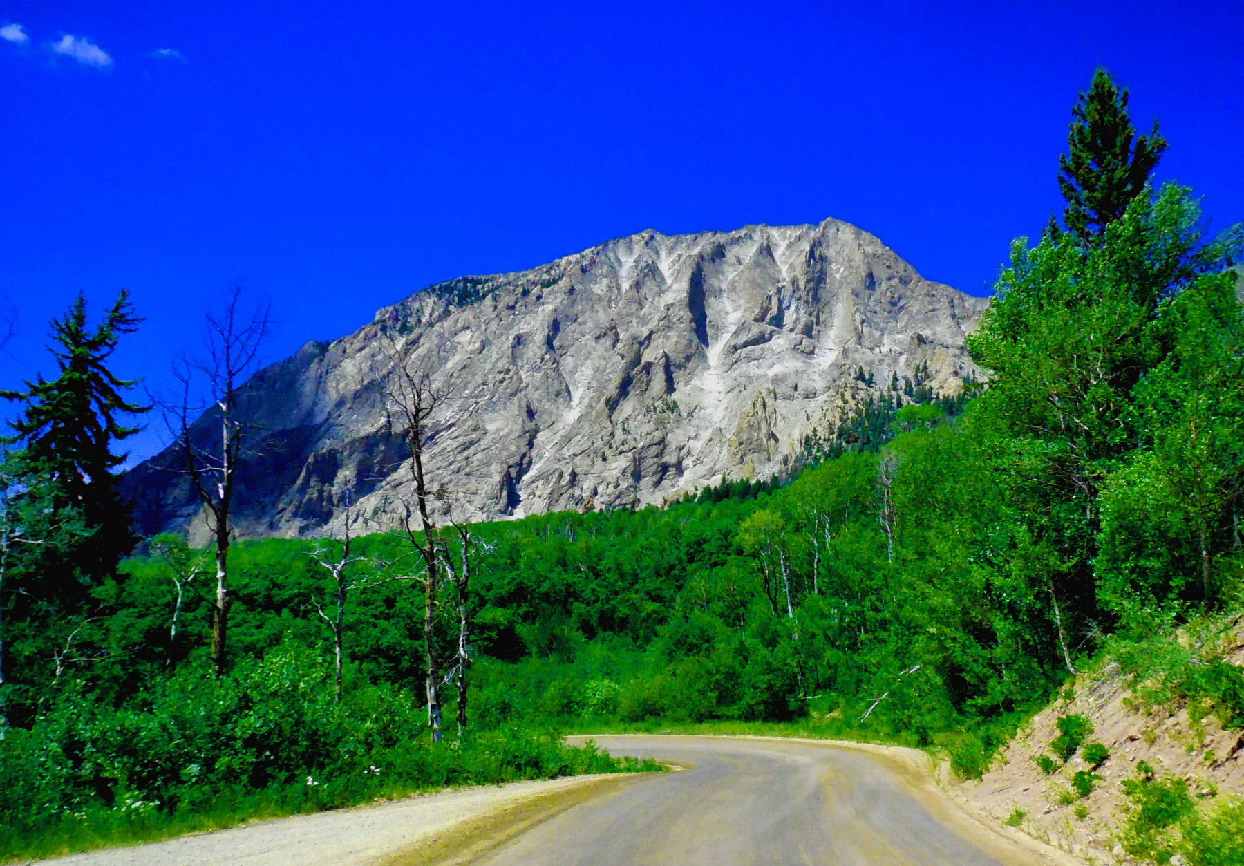
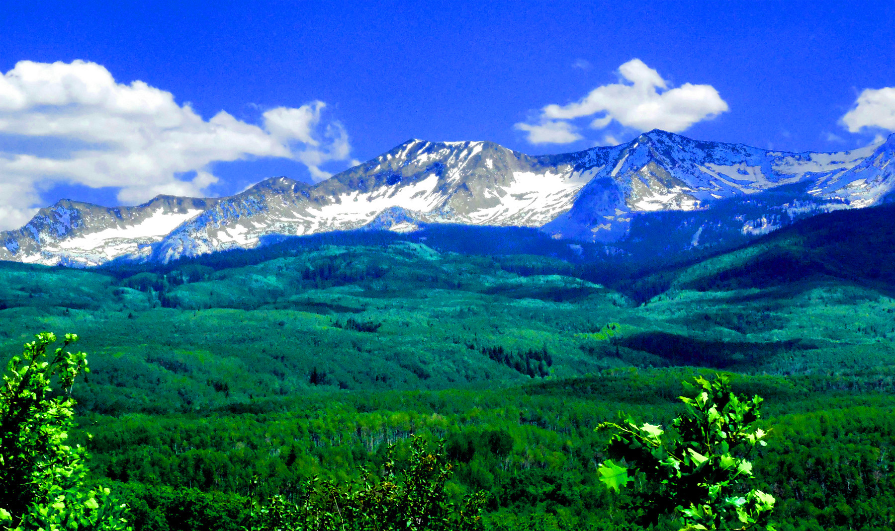
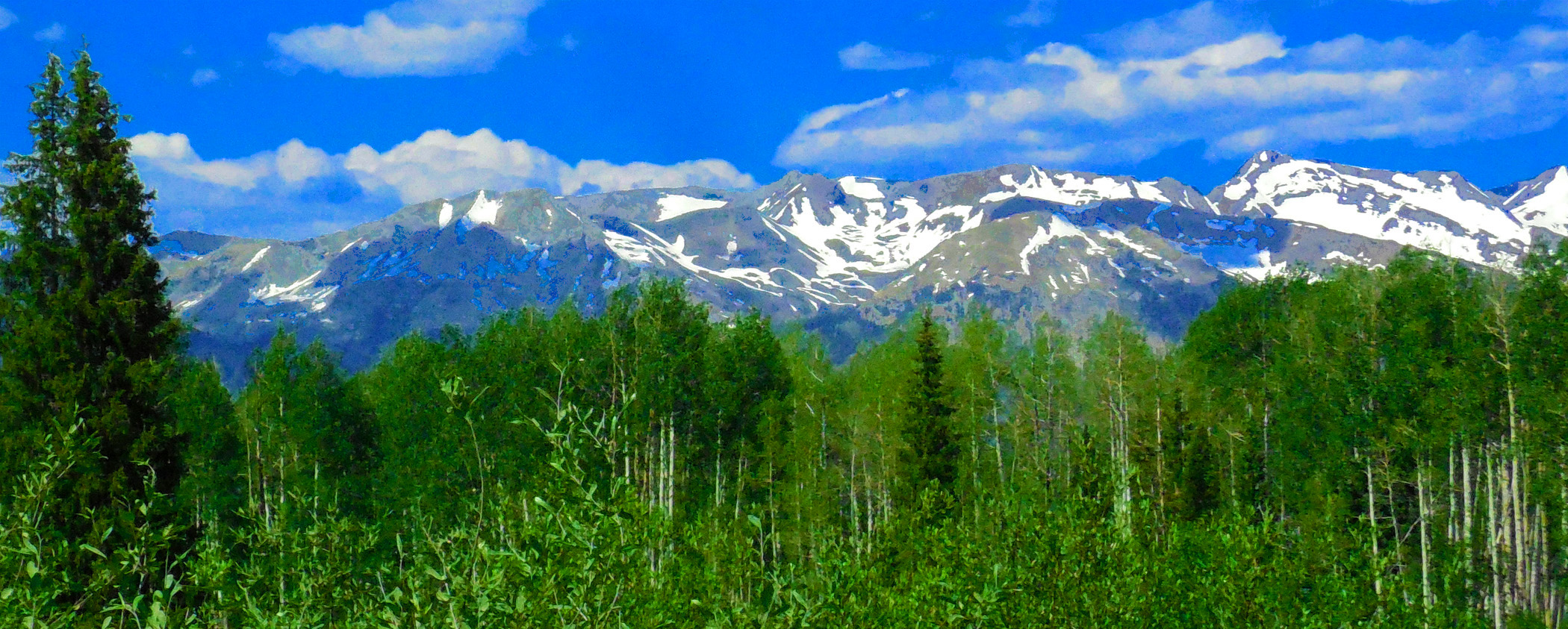
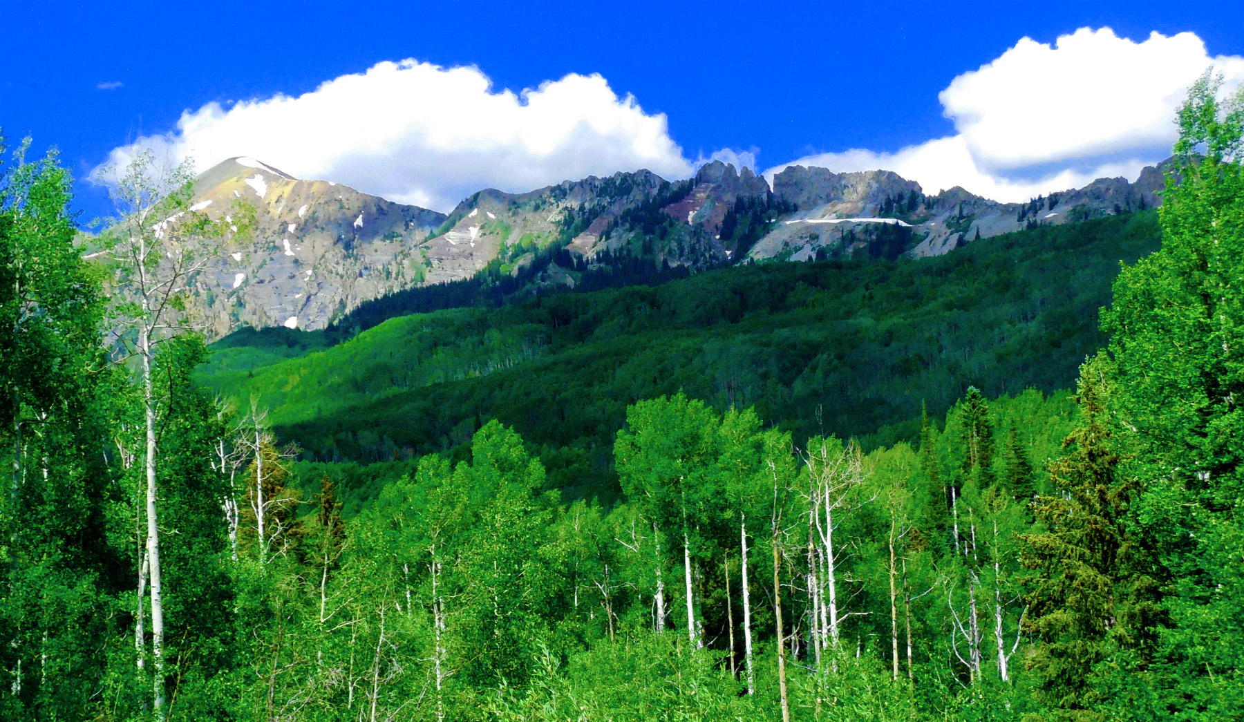
West Elk Mountains Ahead
Jun 27 2017 - 1:30 pm
Jun 27 2017 - 1:30 pm
11 / 47
Headed Up McClure Pass
Feb 26 2017 - 3:42 pm
Feb 26 2017 - 3:42 pm
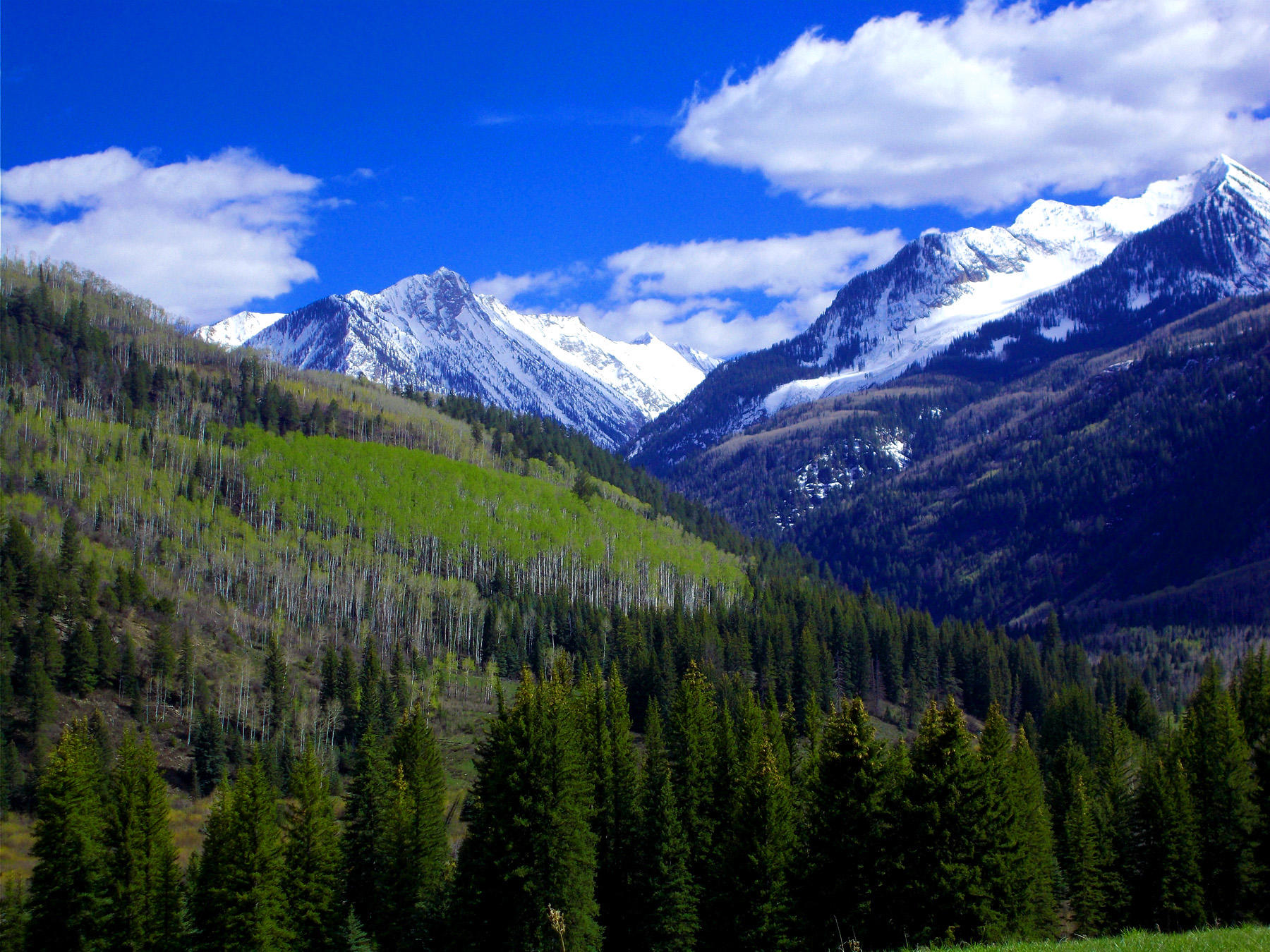
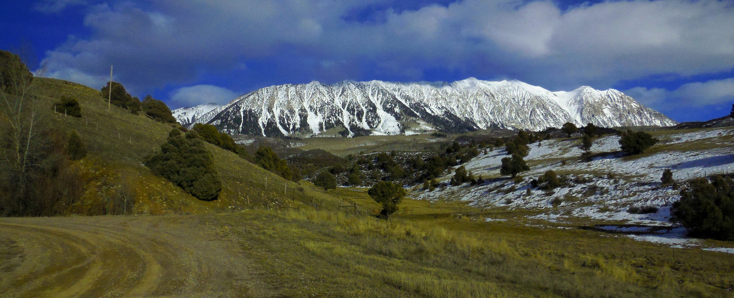
12 / 47
Elk Mountain (11,826' left) and the right arm of the chair of Chair Mountain
May 12 2019 - 4:11 pm
May 12 2019 - 4:11 pm
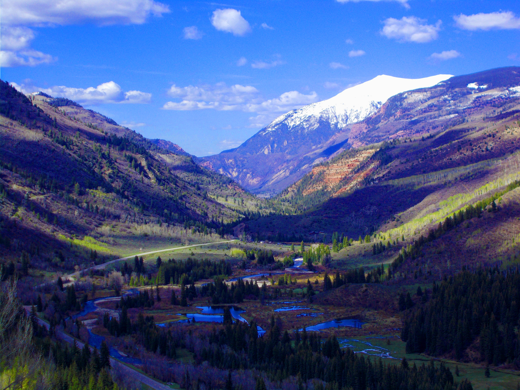
13 / 47
Crystal River Valley (looking downstream, Mount Sopris in background)
May 12 2019 - 4:20 pm
May 12 2019 - 4:20 pm
14 / 47
Northern West Elk Mountains from Mount Sopris (left) to Chair Mountain (right)
May 12 2019 - 4:27 pm
May 12 2019 - 4:27 pm
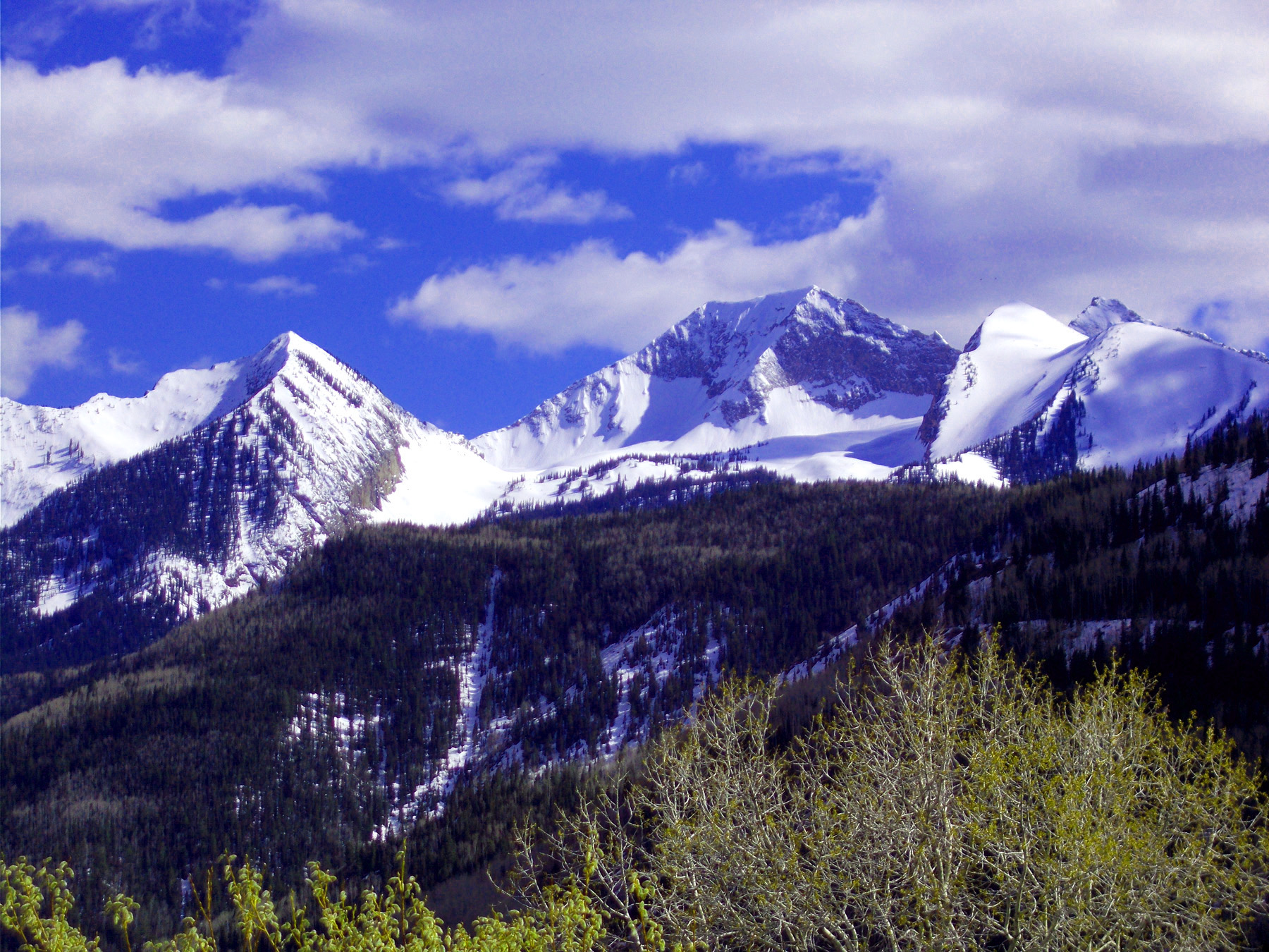
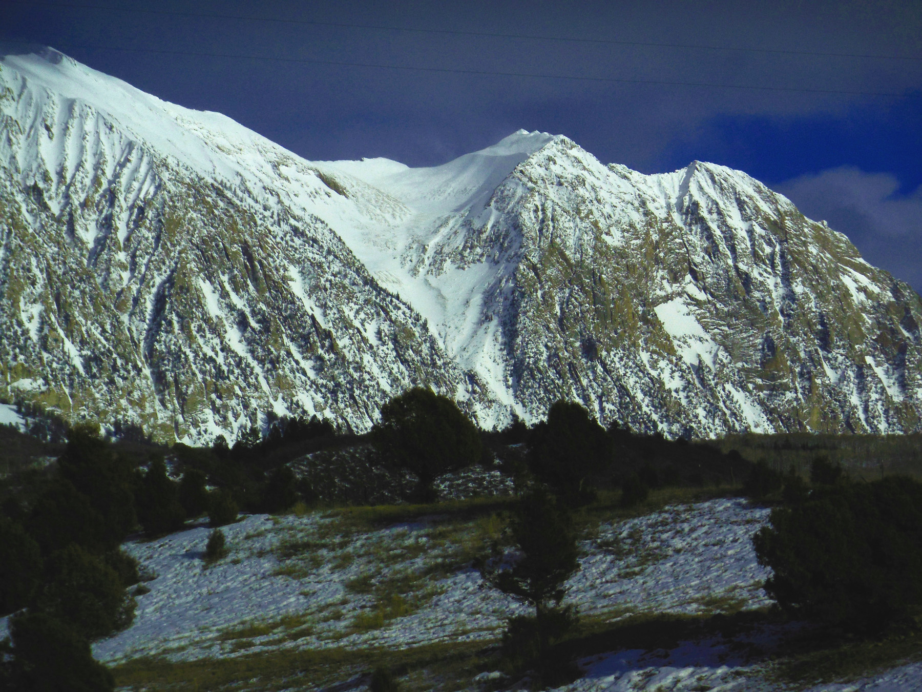
15 / 47
Chair Mountain (12,781')
May 12 2019 - 4:28 pm
May 12 2019 - 4:28 pm
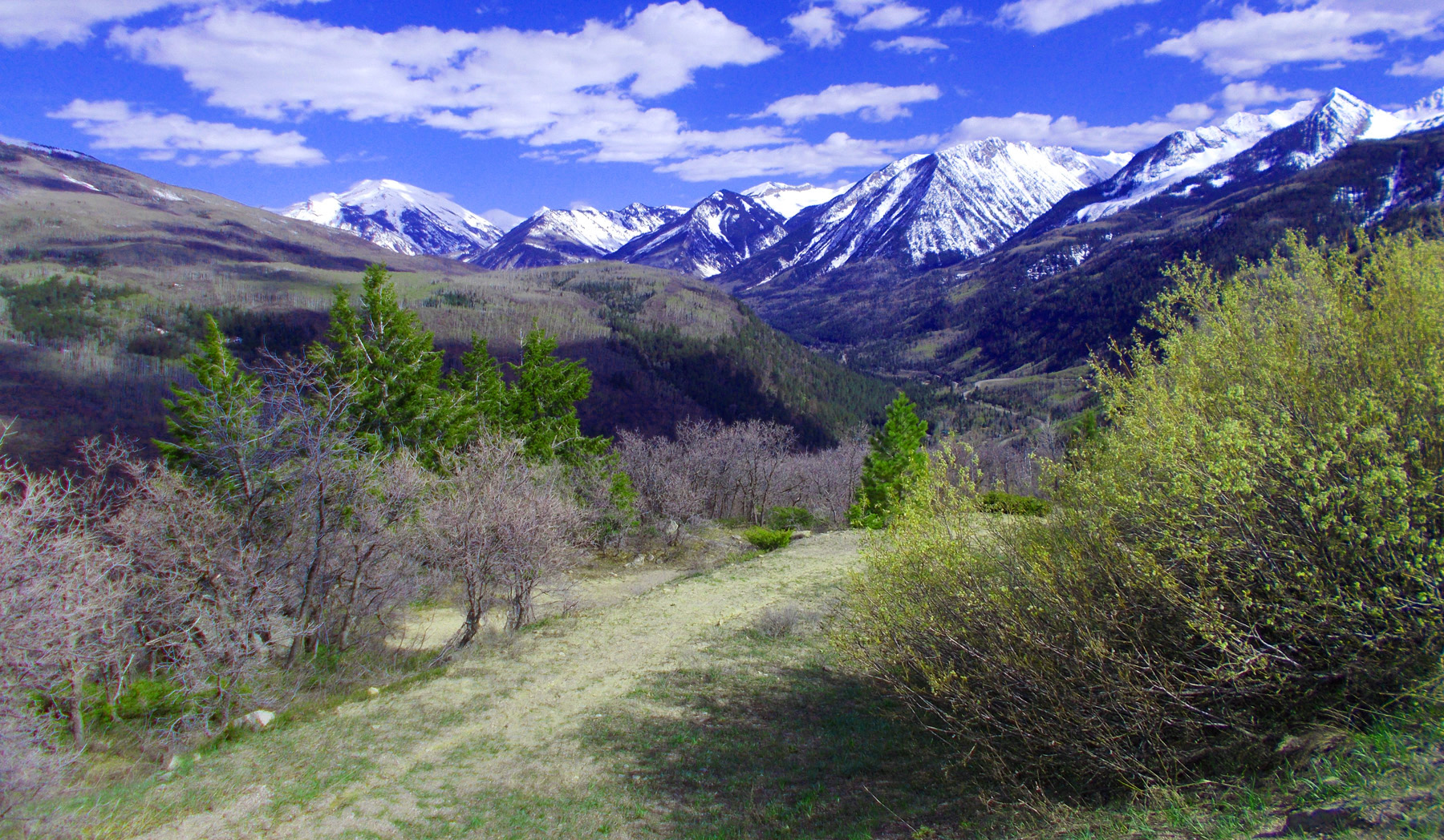
16 / 47
Elk Mountain and Upper Crystal River Valley
May 12 2019 - 4:28 pm
May 12 2019 - 4:28 pm
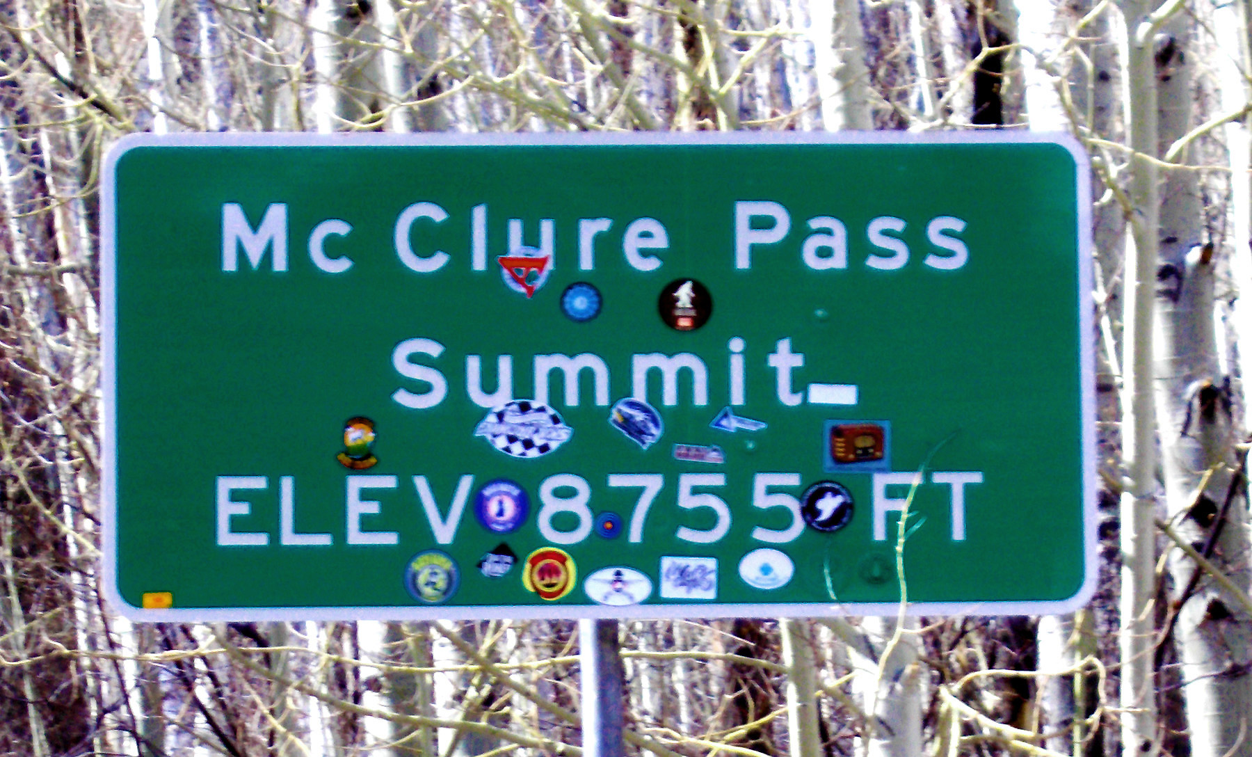
17 / 47
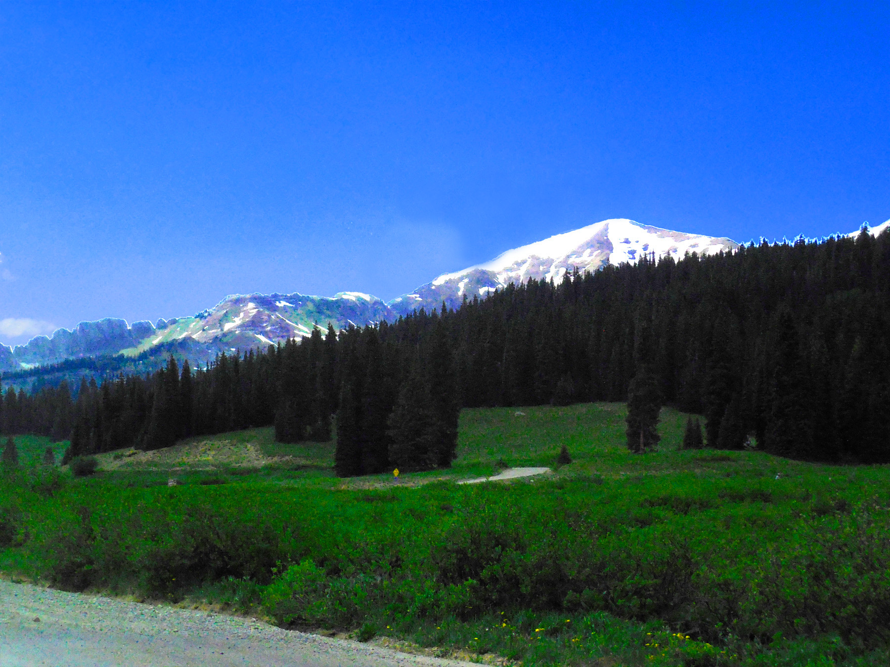
McClure Pass
May 12 2019 - 4:32 pm
May 12 2019 - 4:32 pm
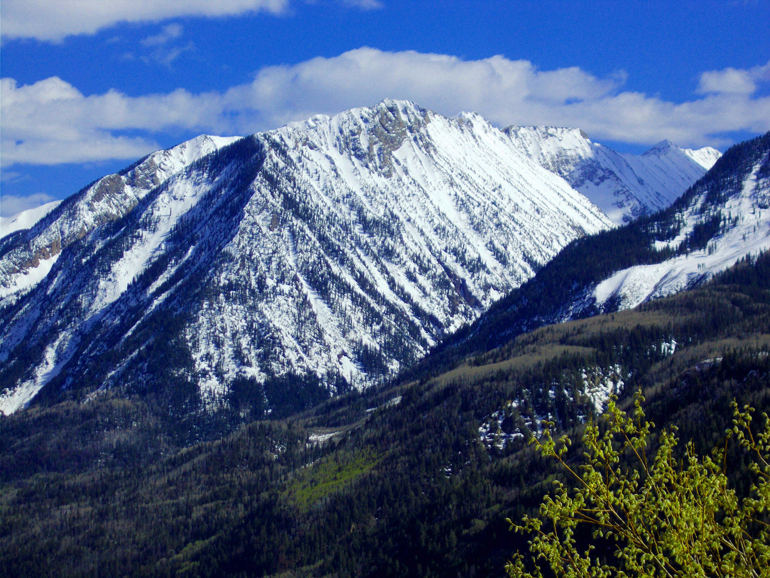
18 / 47
Chair Mountain and north end of the Raggeds
May 12 2019 - 4:55 pm
May 12 2019 - 4:55 pm
19 / 47
The Raggeds
Feb 26 2017 - 4:29 pm
Feb 26 2017 - 4:29 pm
20 / 47
Raggeds Peak (12,650')
Feb 26 2017 - 4:29 pm
Feb 26 2017 - 4:29 pm
21 / 47
Marcellina Mountain (11,348')
Feb 26 2017 - 4:38 pm
Feb 26 2017 - 4:38 pm
22 / 47
The Raggeds from Paonia Reservior
Feb 26 2017 - 4:50 pm
Feb 26 2017 - 4:50 pm
23 / 47
Telephoto
May 12 2019 - 5:26 pm
May 12 2019 - 5:26 pm
24 / 47
Gravel Road to Crested Butte (open from early June to mid to late October)
Jan 13 2020 - 4:37 pm
Jan 13 2020 - 4:37 pm
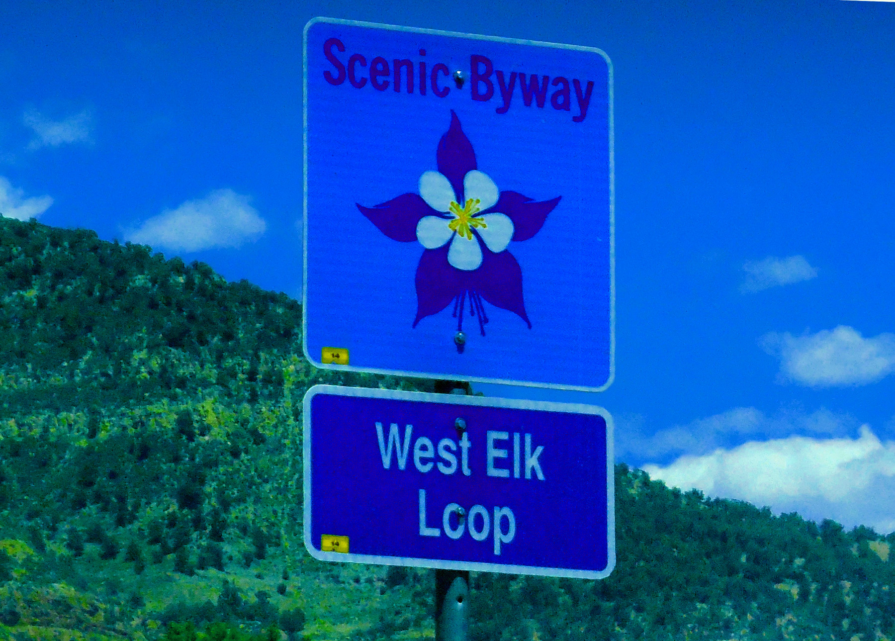
25 / 47
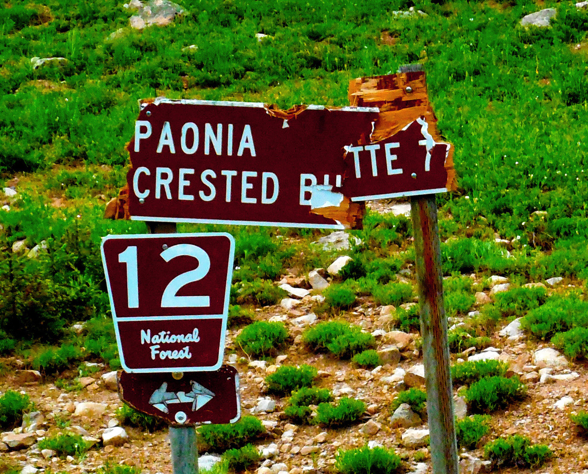
Gunnison County Road 12 (Kebler Pass Road)
turn east just south of Paonia Reservoir
turn east just south of Paonia Reservoir
26 / 47
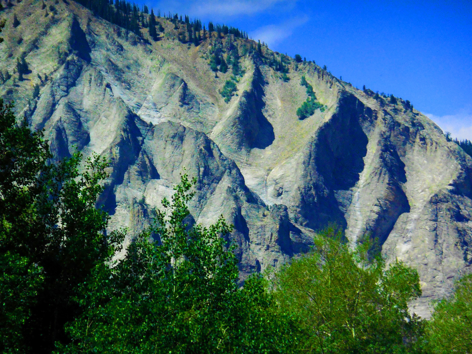
Fluted north face of Marcellina Mountain (typical laccolith of the West Elk Mountains)
Jun 27 2017 - 2:45 pm
Jun 27 2017 - 2:45 pm
27 / 47
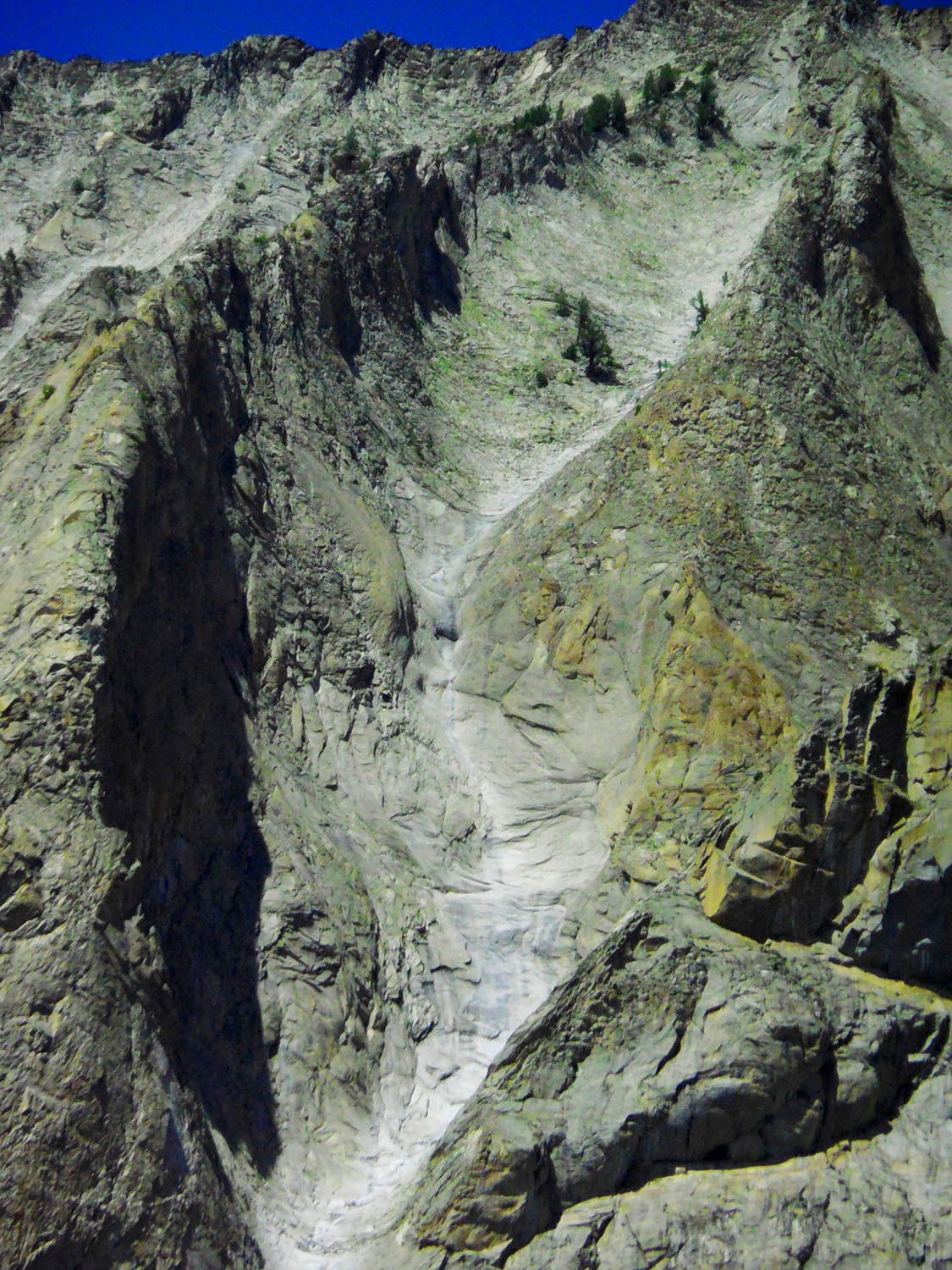
Close Up of Granite Glacial Grooves on Marcellina Mountain
Jun 27 2017 - 3:00 pm
Jun 27 2017 - 3:00 pm
28 / 47
A Groove (maybe the fins are related to granite intrusion along cracks in the host rock)
Jun 27 2017 - 2:44 pm
Jun 27 2017 - 2:44 pm
29 / 47
East and West Beckwith Peaks
Jun 27 2017 - 2:37 pm
Jun 27 2017 - 2:37 pm
30 / 47
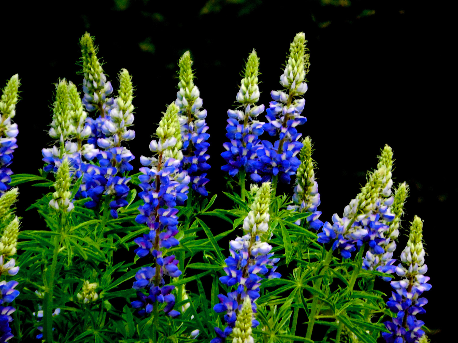
wildflowers everywhere along the roadside
Jun 27 2017 - 3:10 pm
Jun 27 2017 - 3:10 pm
31 / 47
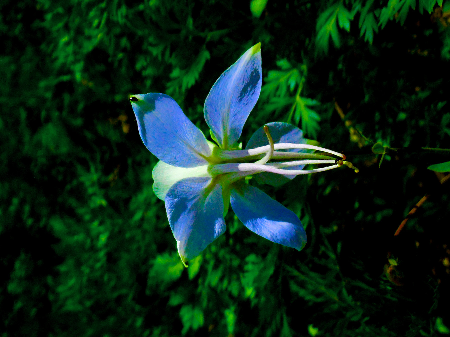
Sky Blue Columbine (Colorado State Flower)
Jun 27 2017 - 3:24 pm
Jun 27 2017 - 3:24 pm
32 / 47
Ruby Range
Jun 27 2017 - 3:44 pm
Jun 27 2017 - 3:44 pm
33 / 47
Ruby Peak (12,644') and the Dyke from the West
Jun 27 2017 - 4:00 pm
Jun 27 2017 - 4:00 pm
34 / 47
Ohio Peak (12,271') and the Anthracite Range (baked coal from heat of the granite intrusions)
Jun 27 2017 - 3:17 pm
Jun 27 2017 - 3:17 pm
35 / 47
Kebler Pass
Jun 27 2017 - 4:23 pm
Jun 27 2017 - 4:23 pm
36 / 47
Ruby Peak and the Dike from the East
Jun 27 2017 - 4:25 pm
Jun 27 2017 - 4:25 pm
37 / 47
Back to CO 133 (south from Paonia Reservior)
38 / 47
Mt. Gunnison (12,719')
May 12 2019 - 4:59 pm
May 12 2019 - 4:59 pm
39 / 47
Telephoto
May 12 2019 - 4:59 pm
May 12 2019 - 4:59 pm
40 / 47
Coal Mine in Mesa Verde Formation
Jun 27 2017 - 1:45 pm
Jun 27 2017 - 1:45 pm
41 / 47
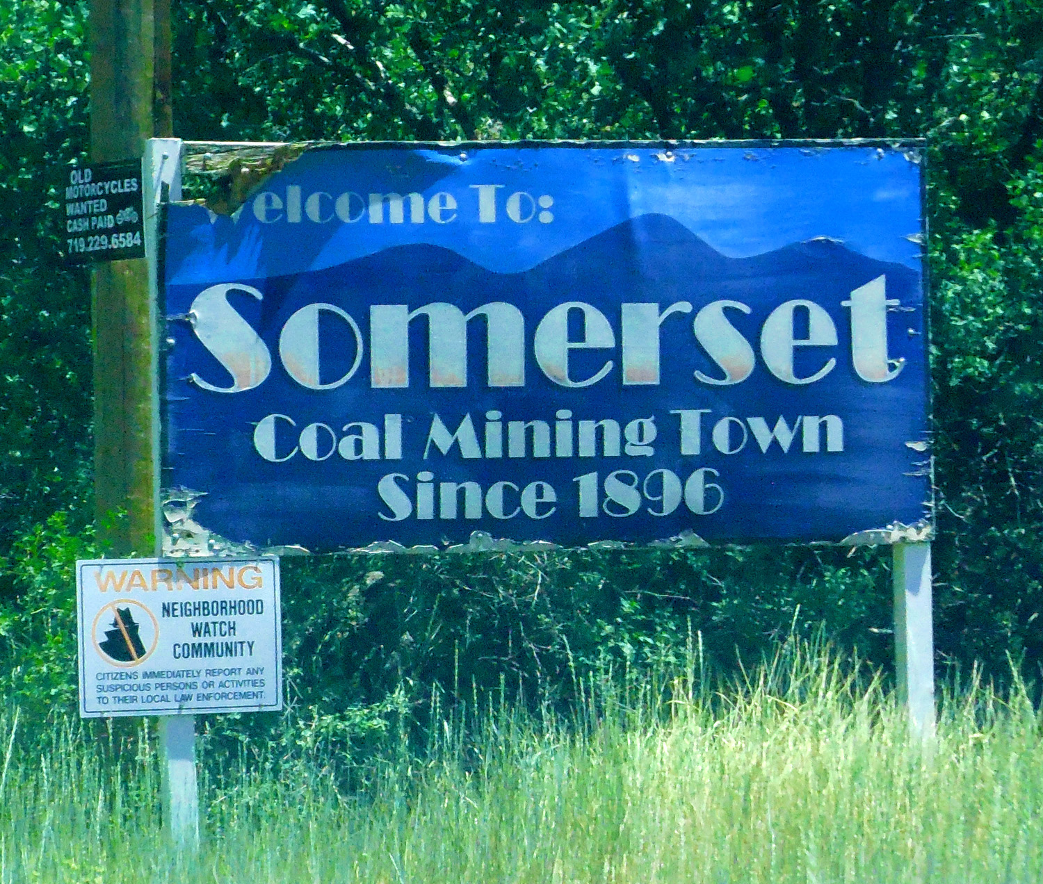
Somerset, CO
Jun 27 2017 - 1:40 pm
Jun 27 2017 - 1:40 pm
42 / 47
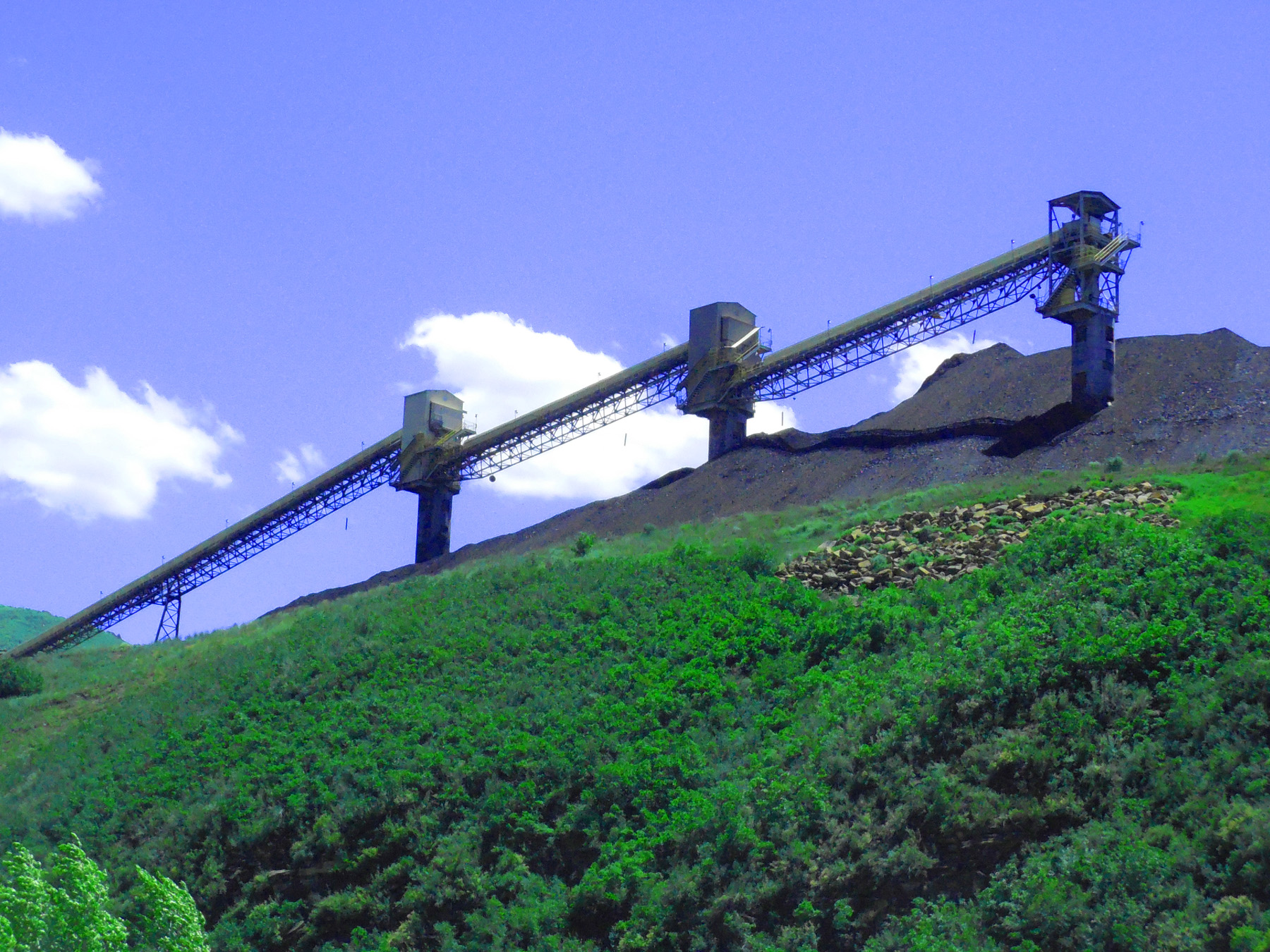
Marching Martians? (ala H.G. Wells, War of the Worlds)
Jun 27 2017 - 1:44 pm
Jun 27 2017 - 1:44 pm
43 / 47
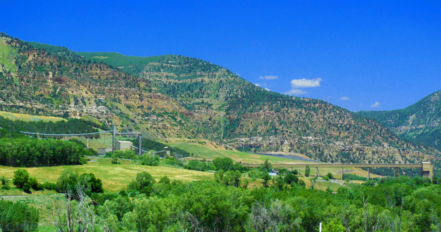
North Fork Gunnison River Valley (coal everywhere)
Jun 27 2017 - 1:32 pm
Jun 27 2017 - 1:32 pm
44 / 47
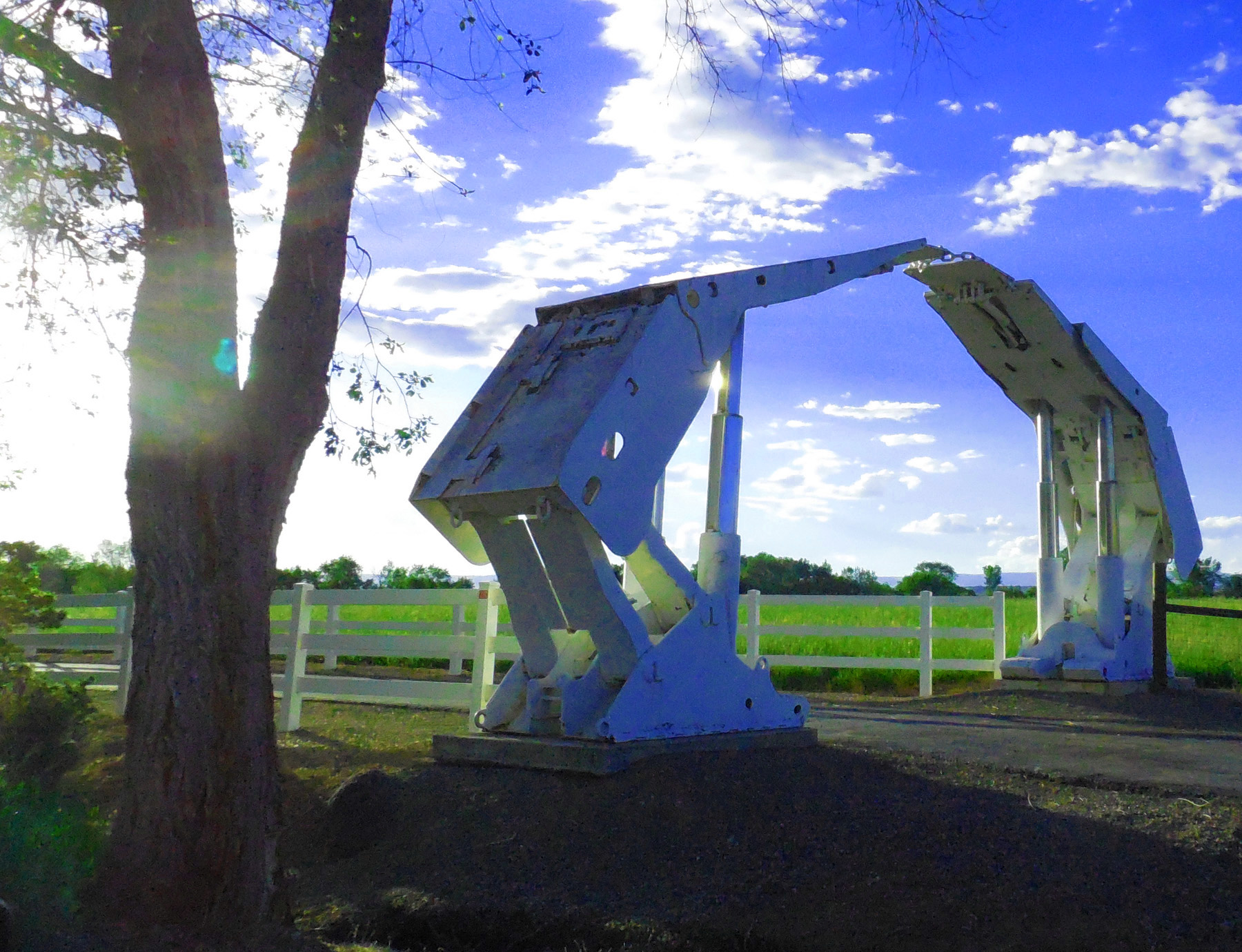
Ranch Entrance near Hotchkiss
Jun 04 2017 - 7:20 pm
Jun 04 2017 - 7:20 pm
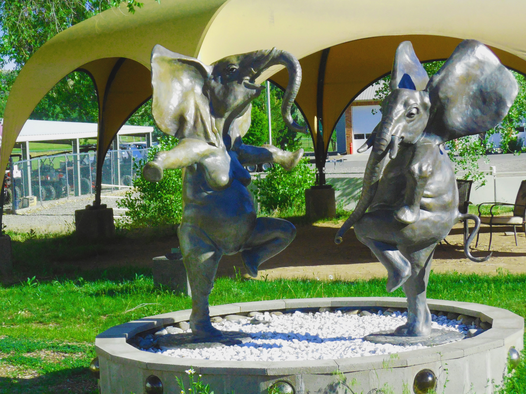
45 / 47
Dancing Elephants in Hotchkiss
Jun 04 2017 - 6:08 pm
Jun 04 2017 - 6:08 pm
46 / 47
Lands End Peak (10,806') at Sunset (southernmost of the granite-cored West Elk Mountains)
May 15 2013 - 8:36 pm
May 15 2013 - 8:36 pm
47 / 47
South End of CO 133
(CO 92 in Hotchkiss)
(CO 92 in Hotchkiss)