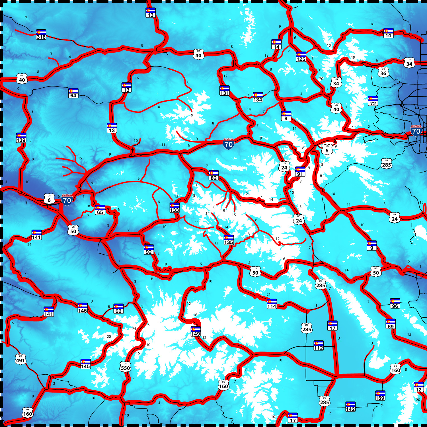
This site displays slide shows of images I took with a Nikon Coolpix (10x telephoto lens) while driving through the Colorado Rockies after moving to Palisade, CO about 4 years ago. Slidea are meant to give a feel for the scenery along US, State, and County roads and selected mountains ranges of the Colorado Rockies and to encourage people to visit Colorful Colorado (redundancy noted). Roads with slide shows are shown as red lines on the image at right; heavy lines show US and State roads; narrow lines, county roads; segments are labeled with the number of photos. See Mountain Index for a map of mountain ranges. For automatic slide shows I modified HTML code from the Navy; for user-control source code is available at w3schools.com. Optional cycle time between images are linked on the Road Index and each set of slides.
I try to include "backward" looks in pictures of each road (not always successfully) but favor forward-looking, snow capped peaks on clear Spring days. I time drives for many roads to capture snow capped peaks on such days. I take 200 to 400 photos on each road photographing trip. Other roads are pieced together from several visits at various times of year. I usually have a camera in the car to snap photos of items of interest such as peculiar lighting. Using Adobe Photoshop I delete duplicates and out-of-focus images, cleanup selected images, and save them as JPG files of 1 Megabyte (MB) or less (small enough to display in 10 second cycle between images on most internet connections). I collect all Photoshopped images for a given road or mountain range in a separate folder often a hundred or more, scan the collection and choose images for slide shows, targeting one image for every 2-5 miles of roadway (50 to 20 images every 100 miles) and for mountain ranges about 50 per range. I don't try to capture the "best" shot just "good enough" to give a feel for scenery along the road. I take many photos through the front windshield while driving. You can see reflections on images on a few slides. The Coolpix camera has troublesome spherical aberration (darkening) in corners of images. So these images are not candidates for photography awards. I propose "miles per image" (last column; lower values are more scenic) as a way to judge scenery. I hope you enjoy the show. The slides may encourage you to drive the roads yourself on a fine day in late March to late May (snow capped peaks) or early October (golden Aspen) or any time of year. In winter check if the passes are open. |
 |