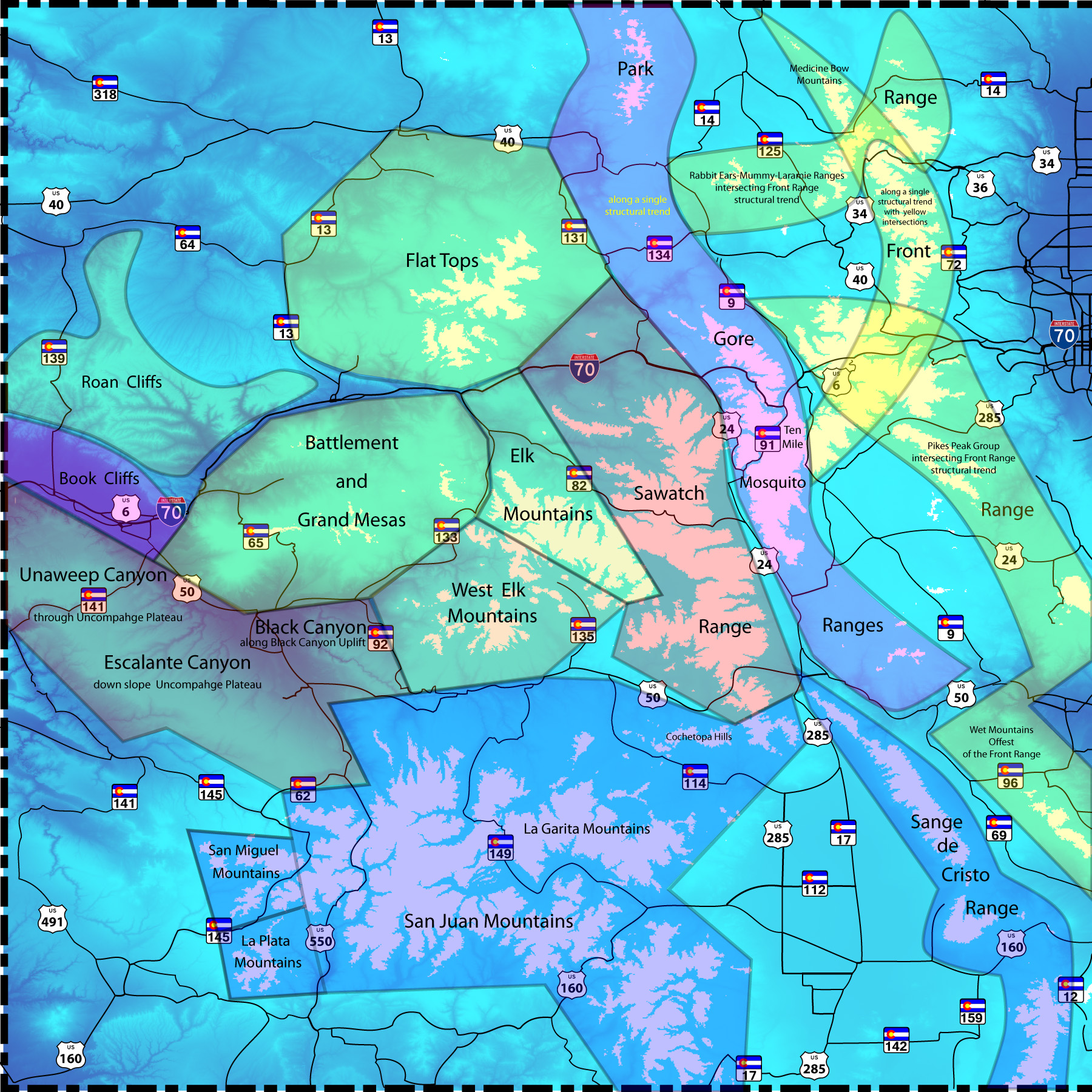
General Description Mountain Range Index links to slide shows of images of the Colorado mountains I took with a Nikon Coolpix (10x telephoto lens) while driving through the Colorado Rockies going on about four years now. Slide shows are meant to give a feel for the scenery of selected mountains of the Colorado Rockies and to encourage people to visit Colorful Colorado (redundancy noted). Mountain ranges with slide shows are shown as shaded areas on the image at right. The jigsaw puzzle of curved stuctures in the front ranges give way to strait-line hexagons to the west. I drew boundaries based on topopgraphic expression and my interpretation of geology of the region. Boundaries encompass similar names on most maps. Images are classified according to 12 landforms:
► Elk Mountains ► West Elk Mountains ► Sawatch Range ► San Juan - San Miguel - La Plata - La Garita Mountains ► Park - Gore - Ten Mile - Mosquito Ranges ► Sangre de Cristo Range ► Front Range (Medicine Bow, Rabbit Ears, Mummy, Front, Pikes Peak, Wet Mountains, Spanish Peaks) ► Roan Cliffs I try to give a flavor the the ranges, often including spring, summer, autumn and winter photos. I don't try to capture the "best" shot just "good enough" to give a feel for scenery. The Coolpix camera has troublesome spherical aberration (darkening) in corners of images. So these images are not candidates for photography awards. I hope you enjoy the shows. Slides may encourage you to explore the mountains, cliffs, mesas, and canyons of Colorado yourself; the more money you spend - the lower our taxes. In winter check if the passes are open. For general information about images see Road Description accessible through Road Index link above. Finally a link to a Year's Slides from my apartment in Palisade, CO, organized by date then time of day. The link is to a user-controlled cylce with further links to automated cycles. I chose the apartment for the views of: (1) East Palisade, (2) Mesa Verde Formation (3) 10,000' Grand Mesa. (North Palisade runs 3 miles along US 6 - I 70 toward Clifton, view blocked from the apartment by a 10 meter high terrace scarp). |
 |